


Ultimate Guide for Climbing Rwenzori
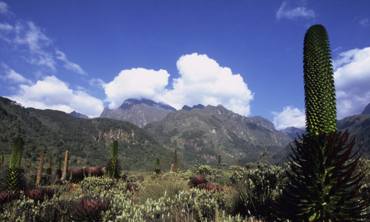
Mount Rwenzori is found along the border of Uganda and the Democratic Republic of Congo. It is commonly called the Mountain of the Moon. The area is filled with steep slopes, deep valleys, waterfalls, and thick vegetation.
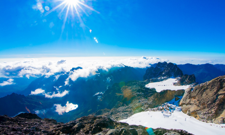
The mountain is very large, covering about 996 km², and stretches 120 km along the border with the Democratic Republic of Congo, Kasese, and Fort Portal. Its highest peak, Margherita, is the tallest in Uganda and the third highest in Africa, standing at about 5,109 meters above sea level.
Around 70 percent of the mountain rises above 2,500 meters. The park itself is 120 km long and 48 km wide, covering the central and eastern parts of the Rwenzori Mountains, which rise above the dry plains north of the equator.
This mountain range is popular with photographers and adventure travelers. It is recognized as a UNESCO World Heritage Site because of its rich biodiversity, making it important for both conservation and scientific study.
The Rwenzori Mountains rise from about 1,600 meters to 5,109 meters above sea level, making them Uganda’s highest mountains and the third highest in Africa.
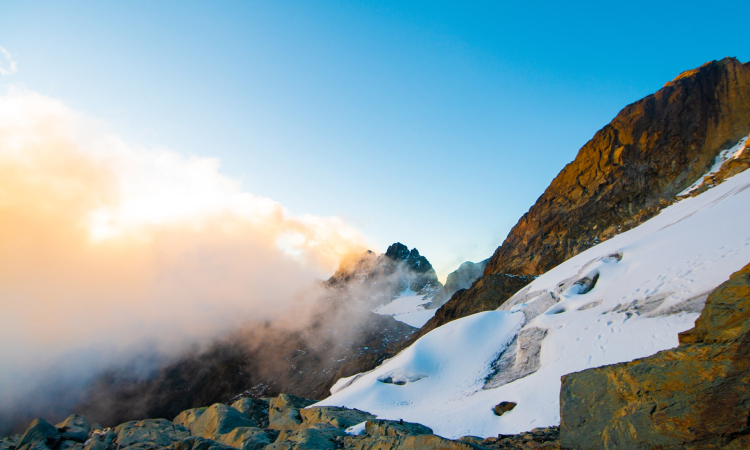
The range is part of Rwenzori Mountains National Park, often described as the snowy source of the River Nile. It is a block mountain, which makes it safe for tourism since it does not erupt.
Because snow covers the peaks throughout the year, the Bakonzo people believed the mountain was a rainmaker and called it Rwenjura. Researchers explain the mist over the peaks as the result of heavy rains, moist air, and high altitudes.
The tallest point, Margherita Peak at 5,109 meters, was named in honor of Queen Margherita of Italy.
History of Rwenzori
Mount Rwenzori, first called the Blue Mountains by Samuel Baker in 1864, was renamed by Henry M. Stanley in 1875 and 1888. In 1906, the Duke of Abruzzi and photographer Vittorio Stella led an expedition, climbing the highest peaks such as Mount Luigi di Savoia.
Stella’s photos are kept at Makerere University and in Italy. After Uganda’s independence, the mountain was used by rebel groups, including the Rwenzururu movement, the NRA, and fighters from the Democratic Republic of Congo. Rwenzori is also rich in natural history, with tropical forests, alpine zones, glaciers, and rocks formed three million years ago.
Facts about Mountain Rwenzori
Mount Rwenzori, also called the “Mountains of the Moon” or “Rwenjura” (rain maker), is found in Kasese District, southwestern Uganda, along the border with the Democratic Republic of Congo near Virunga National Park. The highest point is Margherita Peak (5,109m), snow-covered all year.
Main Peaks
- Margherita Peak
- Mount Speke
- Mount Baker
- Mount Emin
- Mount Gessi
- Mount Luigi di Savoia
Key Facts
- Rwenzori is a block mountain, not volcanic, and will never erupt.
- Glaciers, rivers, and rainfall provide water and hydroelectric power.
- Trekking routes are planned for safety, usually starting very early in the morning.
Rwenzori Trekking Routes
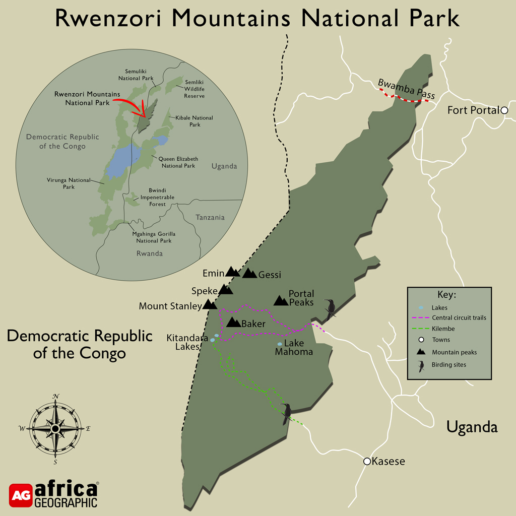
The Rwenzori trekking routes offer tourists a chance to see landscapes, streams, wildlife, and vegetation inside Rwenzori Mountains National Park, managed by the Uganda Wildlife Authority. Every trek is guided for safety. The main routes are the Central Circuit Route, Kilembe Route, and Bukurungu Wilderness Trail.
- Central Circuit Route: Oldest, shortest, and easiest, passing valleys and gorges, often used by hikers to Margherita Peak.
- Kilembe Route: Longer with modern facilities, about 7–8 days, showing glaciers, plants, and animals.
- Bukurungu Route: Quiet, with four lakes and bush camping, about 8 days.
Choose a route that fits your ability and comfort.
Tourist Activities – Top Things to do in Rwenzori Mountains
Mount Rwenzori offers visitors many activities to enjoy during their safari.
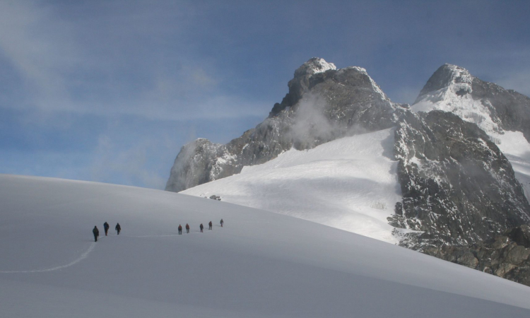
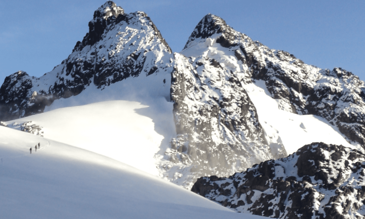
- Mountain Climbing: Hiking is the main activity, with routes like the Kilembe Trail and Central Circuit, usually taking about eight days. Hikers need strong shoes, jackets, snacks, water, insect repellent, a first aid kit, walking sticks, and a waterproof backpack. They rest in huts and wake up early, with summit hikes starting around 4:00 am.
- Bird-Watching: Birding is also popular, with species like the regal sunbird, chestnut-throated apalis, and long-eared owl.
- Community Tourism: Cultural visits allow tourists to meet the Bakonzo people, join dances, songs, drumming, and learn about local food and herbal medicine.
Tourist Attractions – Top Things to see in Rwenzori Mountains
Mount Rwenzori National Park is open all year and charges fair entrance fees used for staff and park maintenance.
- Animals & Wildlife: It is home to over 70 mammal species, including elephants, leopards, chimpanzees, and monkeys, with some species found only in the Albertine Rift or the park itself.
- Birds: Birdwatchers enjoy both dry and wet seasons, with species like the Rwenzori turaco, handsome francolin, golden-winged sunbird, and long-eared owl.
- Margherita Peak: Visitors can also see the snow-capped Margherita Peak, known as the “Mountain of the Moon.” Hiking to the peak takes about eight days.
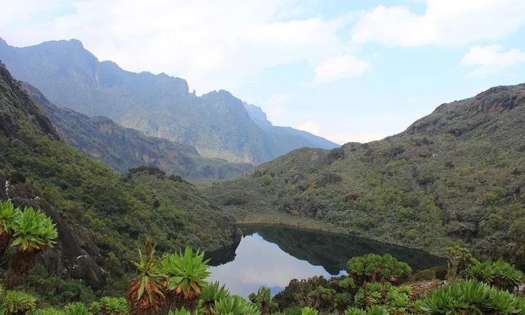
- Beautiful Lakes & Waterfalls: The park also has around 20 lakes, including Lake Mahoma and Lake Bujuku.
Rwenzori Packing List
The Rwenzori packing list helps tourists know what to carry for a safari to Mountain Rwenzori National Park. Before traveling, check Uganda’s rules on allowed items and ask your tour operator for advice. What you pack depends on activities like hiking, bird watching, cultural walks, or nature walks.
Important items include:
- Sleeping bag for cold nights
- Waterproof backpack for essentials
- Warm and light clothes (jacket, gloves, trousers, stockings)
- Walking boots and first aid kit
- Binoculars, sunglasses, and a hat
Porters can also be hired if you cannot carry your backpack.
Map of the Rwenzori Mountains
Best Time to Visit Rwenzori
Mount Rwenzori can be visited all year, but the best season is the dry one from June to August and December to February. Trails are less muddy, skies are clear for photography, and hikers can reach Margherita Peak more easily. Day temperatures range from 10–15°C, while nights drop to 2–6°C.
The mountain lies on the equator with a tropical climate, heavy rains, and fertile soils that support farming. Wet months are April, May, and November, with slippery trails, so hikes should start early.
Recommended hiking months are July, August, September, October, January, and February. Prices are lower during wet seasons.
Getting There/Location
Mount Rwenzori is located on the border of Uganda and the Democratic Republic of Congo. It can be reached by road or air. Most tourists prefer road transport because it is cheaper and more flexible, taking 5–6 hours.
The Fort Portal–Mubende route covers about 300 km, while the Kampala–Masaka–Mbarara–Bushenyi route covers about 350 km with stopovers at markets and the equator landmark.
Chartered flights from Entebbe or Kajjansi land at Kasese or Mweya, then continue by road. At the park, Uganda Wildlife Authority briefs visitors.